File:Kalamazoo map.jpg
Jump to navigation
Jump to search
No higher resolution available.
Kalamazoo_map.jpg (176 × 145 pixels, file size: 6 KB, MIME type: image/jpeg)
Summary[edit]
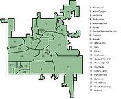
A map of the districts of Kalamazoo, Michigan. Thumbnail, from answers.com, served up by Google Images.
Licensing[edit]

|
This image has been appropriated from wealthy artisans to feed the artistically poor. Good for them, since Uncyclopedia claims a fair use policy. |
File history
Click on a date/time to view the file as it appeared at that time.
| Date/Time | Thumbnail | Dimensions | User | Comment | |
|---|---|---|---|---|---|
| current | 19:46, 22 November 2012 | | 176 × 145 (6 KB) | Spike (talk | contribs) | A map of the districts of Kalamazoo, Michigan. Thumbnail, from answers.com, served up by Google Images. Category:Michigan |
You cannot overwrite this file.
File usage
The following page uses this file: